

Il ciclone tropicale piu' forte del 2009 sara' con tutta probabilita' Nida, guardate che immagini !!!
Loop satellitare (nero = < -90 !)
http://www.goes.noaa.gov/guam/guamlo...amircolor.html
Radar !!!
NWS radar image loop of Long Range Reflectivity from Andersen Air Force Base, Guam
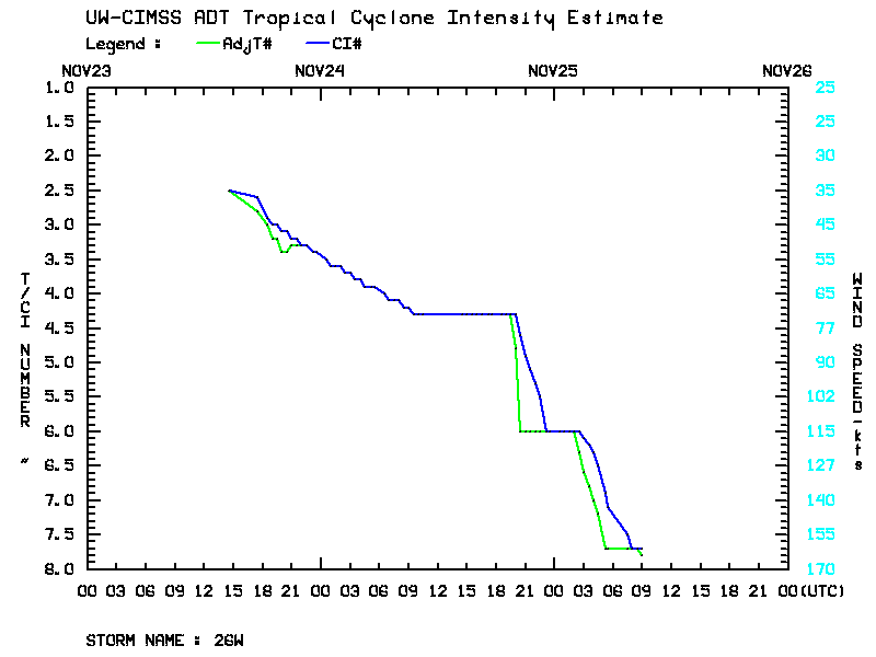
Stima della intensita' a fondo scala !!!!!! (T8.0 !!!!!!!)
http://cimss.ssec.wisc.edu/tropic2/r...dt/odt26W.html
CI# /Pressure/ Vmax
7.7 / 874.2mb/161.0kt
Final T# Adj T# Raw T#
7.7 7.8 8.0
Non ci sono parole, fenomenale !!

...chat con James Reynolds, www.typhoonfury.com
Always looking at the sky...James says:
http://www.wmo.int/pages/mediacentre...nfo_58_en.html
Simone says:
holy s**t....
James says:
now that's something I'd like to film!!
 Permessi di Scrittura


 Rispondi Citando

Segnalibri