


Siamo a circa metà di tutto il lavoro che c'è da fare ma contiamo comunque di redigere l'outlook entro i primi 10 giorni di novembreOriginariamente Scritto da Fabry18


Andrea
notizione!!!!!!
non vedo l'ora, sperando che sia buono e visto che manca la metà del lavoro nemmeno ti chiedo anticipazioni perchè ancora non le avete preparate nemmeno voi....credo
per l'"uno dei più grandi di tutti i tempi".
PS: la foto in avatar risale a metà anni 60.....

~~~ Always looking at the sky~~~
Interessante articolo sugli effetti non consueti della Nina in corso (anche se non ho capito bene tutto causa inglese, tratto dal sito weatheronline):
UN weather agency statement
La Nina behind Australian drought
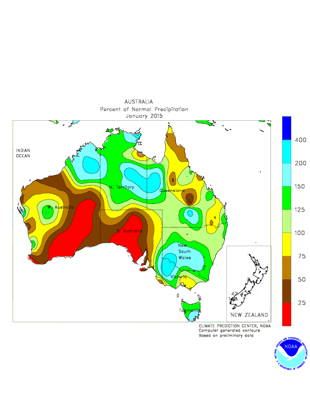
GENEVA, Oct 31, 2007 (AFP) - A long-running drought in Australia is linked to an unprecedented climate pattern which has taken hold in the Pacific basin and Indian Ocean, the UN weather agency said Wednesday. The World Meteorological Organisation confirmed in a statement that a "very clear" disruptive La Nina current was underway across the equatorial Pacific Ocean, in line with its forecast in July. It signalled that the event was associated with "climate-related risks" which needed to be assessed locally in different regions around the world. However, this year's La Nina differed by producing cooler than normal sea temperatures off northern Australia and Indonesian islands -- the opposite of what was expected -- and was unusually combined with separate sea surface temperature shifts in the Indian Ocean. "The drought that's going on in Australia right now is a very serious drought and it is one of the atypical situations associated with this particular La Nina event," said WMO climate specialist Leslie Malone. "The textbooks would have said that Australia would have had a problem with more precipitation than they could handle rather than less," she told journalists, underlining that the current La Nina was "untypical"
La Nina usually combines tropical wind patterns over the Pacific basin with cooler than normal sea temperatures off the west coast of Latin America -- where the ocean is currently 1.5 degrees celsius below normal -- and warmer sea temperatures in the western Pacific. Like its Pacific sibling El Nino, it is widely credited with disrupting weather even further afield. Malone declined to be drawn on other disruptive effects of this year's event but said the agency was issuing an update because there was "an evolution with consequences for people around the world." "Even in a moderate event there can be severe related impacts somehwere. What is difficult to say is where," Malone said. Asked if this year's combination had been seen before, Malone said: "Since this is such a new pattern recognised in the scientific research community, probably not." She emphasised that scientists were unable to clearly tie it with climate change. La Nina is expected to continue into the first quarter of 2008. The WMO had warned in July that La Nina was shaping up the second half of 2007, with the potential for disruptive impact "of planetary scale." Its scientists have also linked the pattern with unusually broad and heavy seasonal floods that recently wrought havoc from East to West Africa. The WMO is trying to build a global consensus of scientific opinion on the pattern and impacts of La Nina and El Nino. "Before we can all sing together, we need more research," said Malone.
ciao

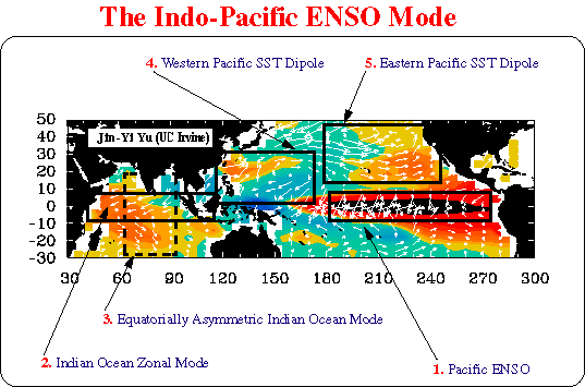
Quest'anno non si sta realizzando il cosiddetto Indo-Pacific ENSO Mode, ossia quella modalità delle SSTA per cui si ha contemporaneamente Nina e DMI (il dipolo delle SSTA nell'oceano indiano) negativo.
Il risultato è che fino a qualche settimana fa le SSTA tropicali a ridosso dell'Australia rimanevano molto fredde inibendo la convezione e il passaggio della MJO, causando un'estesa siccità.
Per fortuna la situazione sta cambiando nelle ultime settimane, e sembra che anche il DMI sia in forte ribasso, probabilmente come conseguenza di una Nina che continua ad intensificarsi.
Ciao Simone
[CENTER]--> Marco <--
***...Always Looking At The Sky...***
""[URL="http://dailymotion.alice.it/video/x3ov8b_peak-oil-how-will-you-ride-the-slid_tech"]How Will You Ride The Slide[/URL]""
[B] Don't panic. But if you panic, be the first.
[/B]
[/CENTER]
Non ha raggiunto il picco La Nina?
Anno 1830. A stento può credersi quanto incostante sia stata la stagione invernale, poichè dal novembre alla metà di febbraio corrente non si sono vedute due godibili giornate consecutive, mentre le nevi sono state replicatissime e magiori di quelle del 1790 e dei freddi del 1813 e 1814.
Gli ultimi loop delle SSTA mostravano ancora qualche accenno all'intensificazione, soprattutto nelle regioni 3 e 3.4.
Domani escono i dati aggiornati alla settimana scorsa regione per regione, vediamo un po'.....
[CENTER]--> Marco <--
***...Always Looking At The Sky...***
""[URL="http://dailymotion.alice.it/video/x3ov8b_peak-oil-how-will-you-ride-the-slid_tech"]How Will You Ride The Slide[/URL]""
[B] Don't panic. But if you panic, be the first.
[/B]
[/CENTER]
Interessante!
sostanzialmente i climatologi sono sorpresi da una strana evoluzione della Nina in zona pacifica occidentale che normalmente dovrebbe apportare in Australia e Indonesia SSTA positive, unite a temperature e anomalie di precipitazioni positive (si sa infatti che con la Nina gli alisei spirano da oriente verso occidente, apportando clima secco e fresco in America latina e caldo-umido verso l'Australia).
Invece:
sostanzialmente pare resistere nella zona una certa tendenza a IOD positivo, che in genere dovrebbe essere sostituito dal pattern opposto nel caso di eventi de La Nina.
A vedere la anomalie di temperatura delle acque oceaniche della zona, si nota che queste "stranezze" si stanno riassorbendo nelle ultime settimane, anche se permane una certa tendenza a scarsa attività convettiva su Australia e Indonesia.
L'evoluzione della MJO in quest'ultimo mese riflette perfettamente la situazione delle SSTA oceaniche: scarsa convezione su Australia e Indonesia (fasi 4-5-6) e forte attività in zona 8-1, tradotto in soldoni pattern configurativo Nina-east.
Roberto
Always looking at the sky....
Ciao Marco, mi pare che concordiamo!
PS: davvero in queste ultime settimane non ho un attimo di tempo per scrivere e documentarmi, e pensare che stanno accadendo un sacco di cose interessanti anche in prospettiva invernale!
Ultima modifica di Casentino; 04/11/2007 alle 15:24
Roberto
Always looking at the sky....

Continuo ad essere ottimista, 1+2 per CFS quasi sicuramente sopra il -1,5 per tutto il periodo invernale. Da metà novembre inizieremo a divertirci, magari ci scappa pure un bel Natale nevoso.

Citta' di Castello(PG):
http://www.tifernometeo.tk/
 Permessi di Scrittura


 Rispondi Citando


Segnalibri