


Questo e'quello che si evince dai rilevamenti effettuati dal sito del wunderground, riporto quello scritto dal Dott.Jeff Master:
An interesting 1002 mb low pressure system with some characteristics of a tropical storm has developed off the coast of Africa, a few hundred miles west-southwest of the Canary Islands. An ASCAT pass from last night revealed top winds of 40 mph near the center, so the low is probably near tropical storm strength. This low is moving east-northeast towards the Canaries, and will likely bring sustained winds of 30 - 35 mph, gusting to 50 mph, to the islands tonight. The storm formed over the weekend from an isolated cold-cored low that was wandering over the Atlantic, and phase space analyses from Florida State University revealed that the low developed a partial warm core over the weekend. A respectable amount of heavy thunderstorm activity has built near the storm's center, characteristic of a tropical storm. The low is over cool 21 - 22°C water, far colder than the typical 26°C needed for a tropical storm to form. These SSTs are about 1 - 2°C warmer than usual for this time of year. Wind shear is marginal for tropical storm formation, about 20 knots. The comma-shaped structure of the storm's spiral bands is characteristic of an extratropical cyclone, and it is pretty unlikely that NHC will view this hybrid storm as being sufficiently tropical to warrant naming it a subtropical depression or subtropical storm. The low is headed towards colder waters of 20°C that lie near the Canary Islands, and the system should become less tropical today.
Ritorna gia'attivo a Febbraio l'Atlantico???
Tacque,e dato di piglio al gran tridente i nembi raduno',sconvolse l'onde,tutte incito'le raffiche dei venti,e di nuvole empi'la terra ed il mare;e giu'dal Ciel precipito' la Notte!
Omero-Odissea
W il Libeccio!!!
Il mio sogno?Vedere la +32°c ad 850 hpa su Roma.
W il caldo!!!
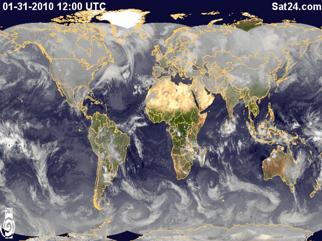
Si vede anche da qui con un pò di attenzione.
Però che bella l'ITCZ, guardate sul Brasile settentrionale, l'Africa centrale e la zona Madden.
"....[I]E vedrete il Figlio dell'uomo, seduto alla destra della Potenza, venire con le nubi del cielo[/I]."
[B]Gesù Cristo[/B] (Marco 14,62)
[B][URL="http://www.luceraweb.eu"]
[/URL][/B]
Ma SK !!!!! Mi sa che ha a che fare con il record del SOI sta cosa, pare che sia andato a -58 grazie ad una esplosione enorme della MJO in fase 8 ed alla pressione molto alta registrata a Darwin.
...chat con James Reynolds, www.typhoonfury.com
Always looking at the sky...James says:
http://www.wmo.int/pages/mediacentre...nfo_58_en.html
Simone says:
holy s**t....
James says:
now that's something I'd like to film!!
E questa esplosione della MJO potrebbe portare conseguenze nel Mediterraneo in modo direttamente proporzionale oppure solo in modo blando???Oppure ancora ininfluente????Originariamente Scritto da Simone Lussardi

Tacque,e dato di piglio al gran tridente i nembi raduno',sconvolse l'onde,tutte incito'le raffiche dei venti,e di nuvole empi'la terra ed il mare;e giu'dal Ciel precipito' la Notte!
Omero-Odissea
W il Libeccio!!!
Il mio sogno?Vedere la +32°c ad 850 hpa su Roma.
W il caldo!!!
 Permessi di Scrittura


 Rispondi Citando

Segnalibri