

"Credo nel potere del riso e delle lacrime come antidoto all'odio e al terrore." C. Chaplin
Always looking at the sky...
Si segnalano TS in tutta la Corsica con venti molto sostenuti.

io ho vomitato sul sedile di un 737 AF (per chi non è pratico af=air france). figo, no? (Fedex dixit)

UchissimaOriginariamente Scritto da nucleo
Forse si tratta di MCS, ma dovrei riguardare i miei appunti di temporalogia!
ESTOFEX warning a livello 2
western Mediterranean
It seems that very moist low-level air mass is present over the W Mediterranean ... which should spread eastwards ahead of the upper low on Sunday. CAPE in this air mass should be in the 1000 to 2000 J/kg range ... maybe even higher. DLS of 15 to 20 m/s ... should maintain threat for supercells and severe multicells ... primary risks being large hail and damaging wind gusts. Especially in the evening and night hours of Sunday ... LLS is progged to increase to 10 m/s ... which ... coupled with nearly saturated maritime boundary layer ... should support a couple of tornadoes as well. Upscale growth into one or more large nocturnal MCSs is anticipated.

io ho vomitato sul sedile di un 737 AF (per chi non è pratico af=air france). figo, no? (Fedex dixit)
non c'è nessuno che lo vede dalle coste sarde? immagino quante saranno fulminazioni sul mare...

Ah però, addirittura a fondoscala la temp. del top delle nubi.
La mia umile stazione meteo
https://www.wunderground.com/dashboard/pws/IREGGI57
Dove andrÃ* ad impattare secondo voi quel bel nocciolo temporalesco?
Intendevo dire su quale tratto di costa italica vi sono le probabilitÃ* maggiori di incrociare quel bell'ammasso?
secondo me la tua provincia la prendera di sicuro

attiviamo gli scudi .....
 Permessi di Scrittura


 Rispondi Citando
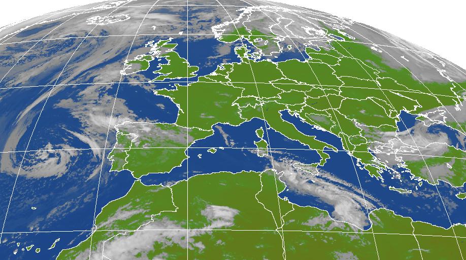


Segnalibri