

sempre prezioso MarcoOriginariamente Scritto da Kallo78

kallo.jpg
28/01/2025: ore 12.14, +19,9 di scirocco.
Il GW è una cagata pazzesca!!!!!!
Dama ritorna presto. Ti aspetto.
Buon venerdì a tutti. Sto tirando come un matto al lavoro per essere a casa per 2 settimane da domani pomeriggio. Aggiornerò dunque il forum con più cose costruttive nella settimana del super caldone!!! (i gm confermano). Bon, detti i cavoli mieisegnalo ufficio con condizionamento a +25, mentre dalla finestra scorgo un cielo quasi sereno (cerasolo ausa). Cerasolo Ausa che segnala anche un +29,9, ur 38%, bava da NE.
Stamattina a Corpolò ho constatato una minima a +20,1.
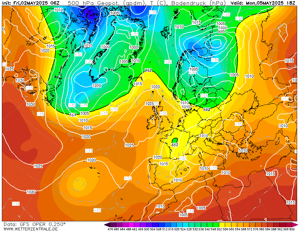
Vediamo sto 06z.
ps
Raf.. le chiavi di Calvillano grazie
28/01/2025: ore 12.14, +19,9 di scirocco.
Il GW è una cagata pazzesca!!!!!!
Dama ritorna presto. Ti aspetto.
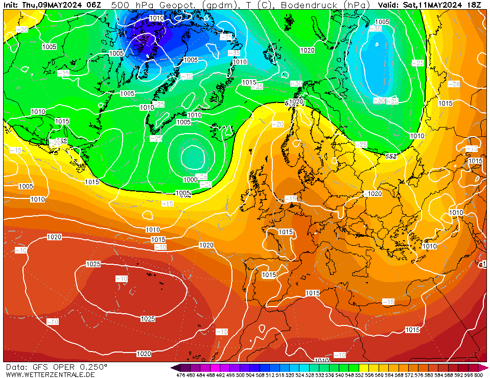
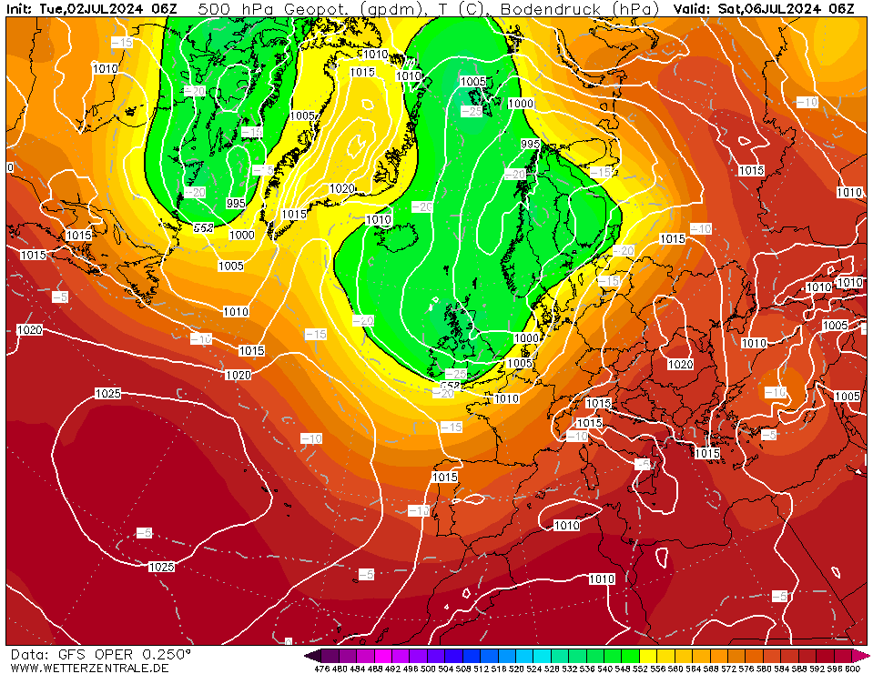
Increased agreement between the latest ECWMF and CFSv2 Sub-Seasonal range models for the most likely circulation pattern over Europe during the month ahead period.The dominant mode of variability for next 2-3 weeks appears to be a positive phase of the East Atlantic Pattern (EA) and a negative phase of the NAO index (NAO has trended much more negative than previous forecasts). This favours low pressure areas over NW Europe and high pressure ridges often located over S+E half of Europe. This is a pattern that has typified many summers since 2007 and there is speculation that this pattern is more likely during periods of rapid Arctic summer sea ice melt, such as we are experiencing again this summer. Arctic Sea ice melt rate is close to 2012 levels currently (record minimum).Thus, greatest persistent warmth (with a couple of notable heatwaves, such as the one in Wk31) likely over S+E half of Europe. Italy and Balkans and S+E Alps especially prone to further very hot and dry anomalies.
Della serie: la prossima sberla potrebbe anche non essere l'ultima.

"La democrazia, a differenza di altri sistemi reggitori, è quella situazione politica e social-politica, dove il popolo viene preso a calci dal popolo, su mandato del popolo; è la pratica certosina dell'autoinganno C. Bene
Com'è umano lei!
 Permessi di Scrittura


 Rispondi Citando


Segnalibri