

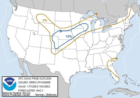
As expected...day2 MDT risk is out for west KS and central TX/OK Panhandle... mmm gimme someOriginariamente Scritto da Aragorth


http://www.spc.noaa.gov/products/outlook/day2otlk.html

Marko Korosec, Slovenia
Severe Weather Europe - http://www.severe-weather.EU
www.Weather-Photos.NET | http://www.facebook.com/WeatherPhotos.NET
The best chasing area, in USA?
mmm man Texas Panh shear looks impressive even if there's some lack of moisture..Besides it smells of a good cap. So far my target is Sedan NM
Andrea Griffa
www.cacciatoriditornado.it
www.tornado-tour.com
Coautore del libro "temporali e tornado"
Ciao Gabriel,
I motori sono già caldi da un bel 2 mesi almenoA proposito delle illusioni: nella caccia è tutto un enigma fino alla fine, si è sempre dubbiosi fino all'ultimo. Ma ci sono delle priorità che oltrepassano ogni cosa. Se c'è un outbreak con cap forte in Oklahoma il 5 maggio(dalle carte potrebbe anche verificarsi) e la convezione parte dopo le 9pm non mi dire che quella sera stai a casa. Un tentativo bisogna farlo per forza, anche se siamo stanchi e disperati.
(ma solo se c'è roba grossa in ballo, tipo un highr risk, per esmpio)L'errore di fermarsi l'ho già fatto e mi è costato tanto.
Il discorso è il solito quesito che ricorre in medicina: il rapporto rischio-convenienza/beneficio
Andrea Griffa
www.cacciatoriditornado.it
www.tornado-tour.com
Coautore del libro "temporali e tornado"
LOL man, thats the true power of great chaser! Respect!!!
Marko Korosec, Slovenia
Severe Weather Europe - http://www.severe-weather.EU
www.Weather-Photos.NET | http://www.facebook.com/WeatherPhotos.NET
Yeah, thats the best chasing area for sure!
Man I was shocked when I saw that shear conditions over PanhandleToo bad moisture return isn't so magnificant, but I still think thats good enough.
Marko Korosec, Slovenia
Severe Weather Europe - http://www.severe-weather.EU
www.Weather-Photos.NET | http://www.facebook.com/WeatherPhotos.NET
cico inutile stare li nemmeno a pensarci x due motivi: lo scenario HIGHRISK cappato proprio a oklahoma city il 5 maggio mi pare un tantino improbabile e in più arriviamo la alle 8 di sera. ora che scendi dall'aereo che prendi le valigie sono le 22, quindi devi attivare il WX e andare ad affittare l'auto...
il 5 maggio non è giornata ne serata di caccia x noi. bisognerà vedere se saremo pronti il 6 piuttosto.
raga con oggi inizia una maratona di virtual chasing. ci sono 6 giorni di caccia di fila. se fossi la probabilmente salterei domenica. ecco i miei targets:
oggi: SW Nebraska
domani: Texas Panhandle
domenica: riposo
lunedi: Texas Panhandle
martedì: SC-SE Kansas (outbreak harper cauni)
mercoledì: SC-SRN Plains (missouri,alabama,louisiana,arkansas)
SFERA DI CRISTALLO:
GFS06 di oggi continua a confermare la tendenza di un cavo d'onda dopo il 2 maggio. tempistisca e intensità di questo sono tutte da vedere, ma ormai io ci scommetteri su un periodo di maltempo a partire dal 3-4 in poi.
ecco una carta x le 18UTC del 5 maggio:
lol and I was just about to post this image nowMan that looks amazing for May 5th...but I am not dissapointed we can't chase that day...if this trend continues...look at the juicy stuff over Pacific...there is plenty of chasable days if this trend stays over there
Marko Korosec, Slovenia
Severe Weather Europe - http://www.severe-weather.EU
www.Weather-Photos.NET | http://www.facebook.com/WeatherPhotos.NET
wow, appena uscito da SPC:
DAY 4-8 CONVECTIVE OUTLOOK
NWS STORM PREDICTION CENTER NORMAN OK
0328 AM CDT FRI APR 20 2007
VALID 231200Z - 281200Z
--ORGANIZED SEVERE WEATHER EPISODES WILL BE POSSIBLE OVER THE
SRN/CNTRL HIGH PLAINS MONDAY...APRIL 23RD...THE SRN/CNTRL PLAINS
TUESDAY...APRIL 24TH AND THE ARKLATEX INTO LOWER MS VALLEY
WEDNESDAY...APRIL 25TH.--
...DISCUSSION...
DESPITE SLIGHT DIFFERENCES IN TIMING...LATEST MEDIUM RANGE GUIDANCE
IS RELATIVELY CONSISTENT IN INTENSIFYING UPPER TROUGH OVER THE
ROCKIES ON DAY 4 /APRIL 23RD/...SHIFTING IT E INTO THE CNTRL/SRN
PLAINS ON DAY 5 /APRIL 24TH/...AND THEN DEAMPLIFYING IT AS IT
TRANSLATES EWD THROUGH THE REMAINDER OF THE EXTENDED PERIOD.
VERTICAL SHEAR WILL CORRESPONDINGLY INCREASE ACROSS A SUFFICIENTLY
MOIST WARM SECTOR SUCH THAT IT APPEARS THAT MULTIPLE SEVERE STORM
EPISODES WILL BE POSSIBLE.
 Permessi di Scrittura


 GFS is good, but WRF is even better. My preliminar target would be Dumas, TX.

 Rispondi Citando

Segnalibri