

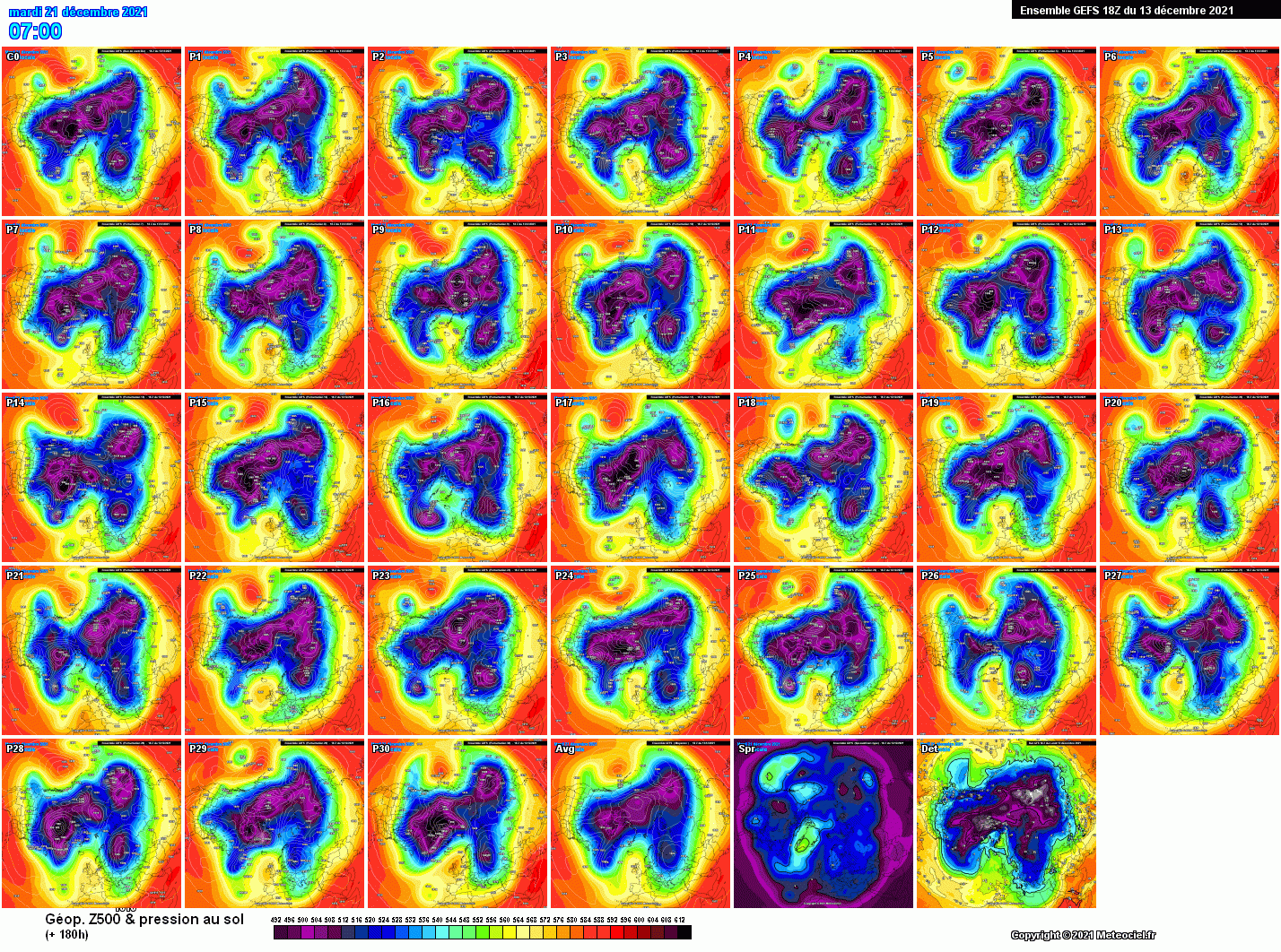
Gfs18 esagerato :D
Parlando della prima fase giustamente.Originariamente Scritto da Alessandro1985

Posta quelli adriatici anche


Sul web si trova di tutto, Ecmwf fa un intero documento di sintesi annuale: Evaluation of ECMWF forecasts, including the 2021 upgrade | ECMWF
Figure 4 shows the evolution of the skill of the high-resolution forecast of 500 hPa height over Europe
and the extratropical northern and southern hemispheres since 1981. Each point on the curves shows the
forecast range at which the monthly mean (blue lines) or 12-month mean centred on that month (red
line) of the anomaly correlation (ACC) between forecast and verifying analysis falls below 80%. In both
extratropical hemispheres, in 2020-21 the score has surpassed all previous 12-month values.
Inviato dal mio Redmi Note 7 utilizzando Tapatalk


C'ho la falla nel cervello
Che carte signori, vorrei piangere ma le lacrime le ho finite tutte per il finale di Breaking Bad
Inverno 2011/2012: 6-7 Febbraio 2012 (3 cm a terra, 7-10 cm eolici)My sitometeo con dashboard di tutti i dati della mia stazione aggiornati ogni minuto --> http://marconiameteo.altervista.org/
Ultima immagine 4K (aggiornata ogni minuto) --> https://assets3.webcam.io/w/P1a2OP/latest_hd.jpg
My Webcam 4K in Marconia (MT) - direzione N (si vedono 2/3 della Puglia + Adriatico) --> https://webcam.io/webcams/P1a2OP (timelapse)
Inverno 2012/2013: 9-10 Febbraio 2013 (Neve farinosa)
Inverno 2013/2014: l'inverno del nulla cosmico.
Inverno 2014/2015: el buco metapontino
Inverno 2015/2016: nada de nada
Inverno 2016/2017: 6-7-8-9-10 Gennaio 2017 "The Story" (>20cm)
Inverno 2018/2019: 3-4 Gennaio 2019 "Goduria (>10cm)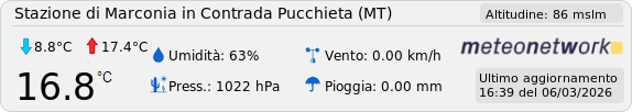
Ecmwf 12 per me è sballato e non c'entra nulla con la nao negativa vista dalle sue stesse eps...
No veramente una carta del genere con quella data...in America ci vogliono male dai
Ce nè per tutti i gusti
Inviato dal mio iPhone utilizzando Tapatalk
Mmm qualcosa nel weekend si può vedere in adriatico, un po' di divertimento ci potrebbe essere
 Permessi di Scrittura


 Rispondi Citando


Segnalibri